Picture this, you get your running clothes on, lace your shoes up, take that last swig of water, and head out for your run and it is not already over 80 degrees with 80% humidity. Sounds nice huh? Well that time is getting closer as fall approaches. As the temperatures start to drop down (hopefully), students come back, and cross country kicks off, we recognize more and more people will probably be venturing out and beginning to pick up their mileage. You might be hoping to run a road race later this fall, preparing to nail your military PT test, getting your steps in on walks, or looking to start a new healthy hobby with some friends who are back in town. Whatever it is, we want to help you know some of the great running routes and trails that Manhattan, KS has to offer. I will describe some differences in the route surfaces and then show you the location of them through links and some screen captures, also showing the possible distances. Additionally there is MHK P&R Guide here.

Soft Surfaces
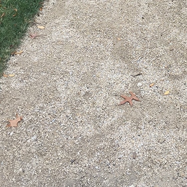
Many of the trails and routes will be on soft surface. This means dirt roads, crushed limestone, and gravel roads. These can be taken for granted in my opinion! These softer surfaces are kinder to your body as you run and pound on your muscles and joints. When concrete pushes back, due to, you know ~physics~, these softer surfaces have more give and can cushion the blow as you press down. I personally try to get most of my miles done on these softer surfaces, but everyone is different! If you haven’t tried them, it could be something new to check out. If you wanted some real killer, hilly, gravel routes, feel free to ask Noah, Trey, Ben and Jackson about ones about 15 minutes East towards St. George off of HWY 24.
Asphalt
A few of the routes will be on asphalt. Typically, running on back roads or shoulders of roads is nice and provides a real smooth route with not a lot of turning and steep hills. This is good for those longer faster efforts where you can get in a rhythm and CRUSH IT. Another good thing about asphalt is that it is technically softer than concrete so it too is just a little bit nicer to your body. Another pro to asphalt is it wont get muddy like the soft surfaces when it rains and they are likely to melt snow quickly. These routes also go on for a long ways and won’t have a lot of foot traffic, great for long runs!
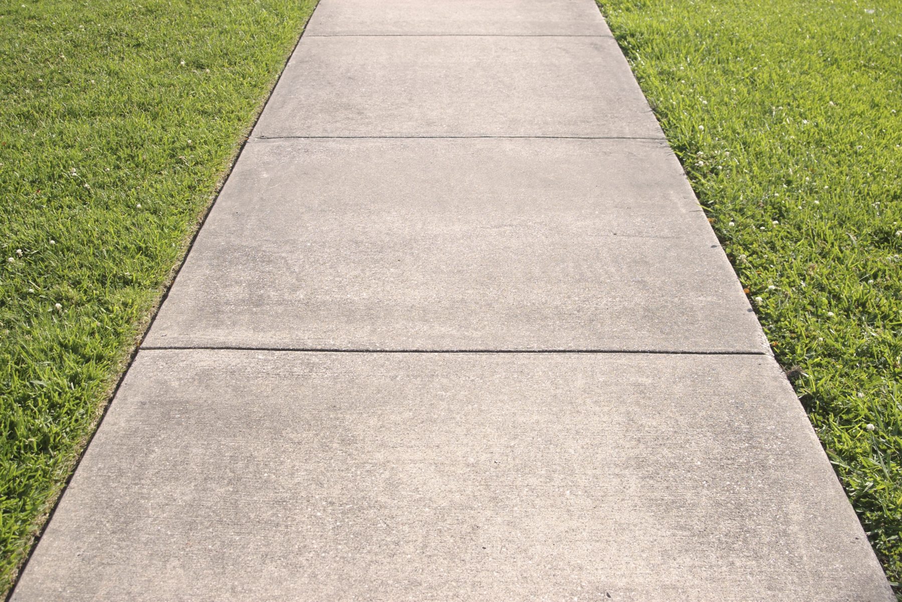
Concrete
A few of the routes and trails are concrete and conveniently close to town. These help you quickly be able to prepare and plan out your run and typically even have marked distances. Once again a bonus to these surfaces is that they won’t get ruined or muddy when the weather takes a turn for the worse. While concrete is pretty hard it can allow for you to run quickly and not worry about footing too much.
– Linear Trail:
Linear – firehouse: Easy, Soft Surface, 2-4 miles
Linear Trail is one of my favorite and one of the most popular trails in Manhattan. It’s trailhead is conveniently close to Manhattan Running Company. It has three sections starting off Anderson by Powercat Sports Bar & Grill and also now the Guilty Biscuit. This section is soft, crushed limestone surface with some very good tree coverage. As of now, August 17,2021, the end of the trail leading into Fort Riley Blvd is involved in the new bridge construction so there is a detour that uses the crosswalk button through Fort Riley Blvd. Typically the trail goes under the bridge and comes out on the other side and begins the concrete section of Linear Trail. But for now you can just accept the minute or two rest!
https://www.mapmyrun.com/routes/view/4574906464

Linear(Planets): Easy, Concrete, 1-2 miles

Next begins the concrete section of Linear, which includes the planet walk. Don’t ask me what it means or what it’s for, I’ll just add the link here if it interests you. This section of linear is nice because it also has some tree coverage. However when weather takes a turn for the worse this section of the trail shows it. After a day of rain you can expect there to be mud and puddles. But this is a really nice part that connects the two soft surface sections. You can park at either the start and the finish too.
https://www.mapmyrun.com/routes/view/4574913427

Linear from Manhattan Ave: Easy, soft surface, 4.5 – 9 miles

This is the final part of Linear Trail and my favorite and probably the most popular. There is a small parking lot at the trailhead right off of Manhattan Ave. From here the trail runs just under 5 miles, and as of now, up to around 6 if you continue towards the additional trail near iHop. There is also an additional parking lot right near HWY 24 if you wanted to split the trail up a bit. Some bad news is that there is no sun coverage anymore, unless you hop onto the right side of the trail with the Manhattan River Biking Trail. This is a fun way to switch up what could be a monotonous and repetitive route. It also gives some wind coverage for when it is really gusting or if it is really cold.
https://www.mapmyrun.com/routes/view/4574918200

– Possible Additions to Linear Trail
Northeast Park: Easy, Soft Surface, 1-2 mile loops
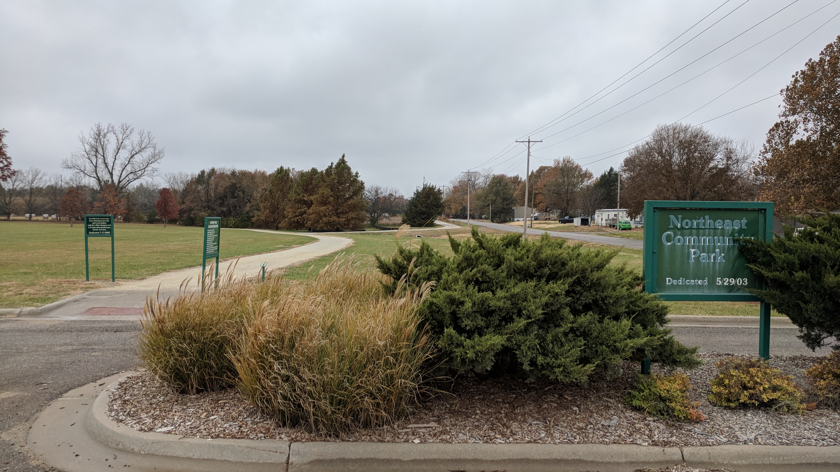 There are few addition routes that you can either add on to your linear route or just do them independently. One is Northeast Park, which features a small baseball diamond, public restrooms, a children’s playground, and even a bird watching trail in addition to the 1.5ish mile loop on soft surface. There is a medium sized parking lot that is never really full as well as a gazebo. Usually the water fountains by the bathroom work but I don’t think they will be turned on while Covid still exists. This trail is really great if you wanted to integrate some interval training into your routines. But, if you just want to get easy miles or walk the dog it is really great for that too. Not a lot of sun coverage and it can sometimes be a little mushy by the creek if it rains a lot.
https://www.mapmyrun.com/routes/view/4574923249

Manhattan Ave/Dump: Easy, Asphalt, up to 6.8 miles

The second additional route is down Manhattan Ave, commonly known as dump loop. This part is great for making a loop that includes the concrete ‘Planets’ section of linear trail. Dump loop features a nice open asphalt road that is pretty much only driven on by dump trucks and the few people who live off the road. The shoulder is plenty wide and the people are courteous and safe drivers. This route is one of my favorite to do an out and back when I want to pick up the pace since it’s a bit easier to get movin’ quicker with the higher traction asphalt rather than the limestone on linear trail. If you can have a friend pick you up it would make a great 5k time trial route.
https://www.mapmyrun.com/routes/view/4574926216

– West Side of town:
Annenberg: Easy, Soft Surface/some concrete, 1-2 miles

Over on the other side of town, just off Anderson Ave, there are a few good options for some miles. The first is Frank Annenberg Park which features a 1.5 mile soft surface with a little concrete loop. Some of which is shaded and typically never really muddy or mushy, dries up quick.
This park is super popular, featuring a turf soccer field, multiple baseball diamonds, a small fishing pond, and it also is connected to Wildcat Fitness and Fun.

This is a versatile spot too, where you could do some faster shorter intervals, even strides on the turf, or just get your easy miles and walks in. Really fun spot with great energy.
https://www.mapmyrun.com/routes/view/4574929861

Wildcat Creek: Moderate, Soft Surface, Up to 11 Miles
Farther down Anderson and a left out of the circle drive is a dirt road named Wildcat Creek. It is known for having Prairiewood Retreat House and Liquid Art Winery. It is a nice road for an out and back that will be a mostly uphill run going out and then downhill coming back. I like to do this route starting from Annenberg, where I park my car, and then run to Wildcat creek and go out and back. The road goes for a while and eventually heads toward Manhattan Regional Airport. But this could easily be a long run route. It would be great for a group run too, allowing a good range of mileage by adding on at Annenberg park by the end.
https://www.mapmyrun.com/routes/view/4574935942

Northwest Side of Town
Hudson Trail: Easy-moderate, Some Soft most concrete, 1-2 miles
Heading North you can find a good string of trails and routes. To start there is Hudson Trail which features a mixture of soft surface and concrete. It is pretty flat with one or two bunny hills. This trail is pretty popular for those who live nearby so it is fun to see smiling faces and say hey.
https://www.mapmyrun.com/routes/view/4574940022

Marlatt Park: Easy, Soft Surface, 1ish miles
If you take Hudson Trail all the way from Kimball you will eventually hit Marlatt Park. This is a beautiful grass part that has various trail routes in a circumference of around 1 mile. This is my favorite place to go when I just need to run easy and free my mind. There can be a few fun technical trail spots back in the woods as well as a bit of mud if there is rain. Luckily your runs aren’t a fashion show and your shoes were made to get dirty. This is great and popular spot to take your dog for a walk or a run and let them take in some fun smells far away from cars or streets.
https://www.mapmyrun.com/routes/view/4574943592

Top of the World: Moderate-Hard, Soft Surface, 6.5 miles
At the entrance of Marlatt Park is ‘Top of the World’, which is just what we call the road Marlatt Ave when it is West of Seth Child. This is a wide dirt road, featuring some gravel with little traffic. It is a bit hilly for most folks but has some good flat parts as well. This road is rarely muddy or mushy which is nice and it has a really nice park that you can climb on a hill to watch either the sunset or sunrise if you time it right. Not too many people know about this road, but more should!
https://www.mapmyrun.com/routes/view/4574947885

NorthEast Side
Casement: Easy, Concrete, 4- 8 miles
Heading more towards the northeast side of town you can find a bunch of back roads that are great to run on. One route I like to do from campus is head towards Casement Rd. If you take Denison to Marlatt Ave and turn right, a sidewalk leads you for about 2.5 miles to Casement Rd. I typically go left and head towards Rocky Ford fishing area. The traffic on this road isn’t bad and it has a good shoulder of asphalt. Depending on your desired distance it can lead into a great longer run route easily accessible from campus.
https://www.mapmyrun.com/routes/view/4574963329

Rocky Ford to Blue River/Cedar Creek: Moderate, Soft Surface, Medium
If you didn’t want to run from campus out North you can park at the Rock Ford State Fishing Area and head towards two of my favorite roads. The first is Blue River Rd. This route will be completely soft surface once your cross casement. It will also feature some good hills and one absolute DOOZY if you keep going for 4 miles and hit Junietta Rd. That being said this is the great long run route that you can match with the route from Denison to Casement. Junietta goes for a while and then comes to an intersection at Green Valley Rd which allows you to go to Elizas Rd, and Mt Zion Rd and from there the possibilities are absolutely endless but if I’m being honest quite brutal. I’m talking HILLS HILLS. But the Rocky Ford to Blue River Rd is a very nice moderate route.
https://www.mapmyrun.com/routes/view/4574967322

Rocky Ford to Cedar Creek: Easy, Soft Surface, Medium
The other option from Rocky Ford is to go farther left on Casement and take Cedar Creek which is a similar but not a long route as Blue River to Junietta. It won’t be too hilly but feature the same soft surface and low traffic roads.
https://www.mapmyrun.com/routes/view/4574969788

South Side:
McDowell Creek Rd: Moderate, Asphalt, Long
The South side of Manhattan is know for the Konza Prairie. If you have been there and know where it is there happen to be a few great roads out there. The first one is McDowell Creek which is right off of the on ramp to HWY 24 heading West. It will be an asphalt road that is typically pretty low traffic. This road is great if there is a brutal North or South wind that you would want to avoid running into and have someone pick you up. It is also great if you wanted to get some road biking done. It really goes on for a while. Definitely One to check out if you are planning a nice long run or bike.
https://www.mapmyrun.com/routes/view/4574972860

Humboldt Creek: Moderate, Soft Surface, Long
A similar north to south road is McDowell Creek Rd. It is drive away towards Fort Riley. Still a relatively low traffic road, and there are a lot of other roads branching off throughout the way. Ex. Tully Hill Rd. This one is for the long run or bike. There can be a mixture of surfaces, mostly asphalt and soft surface. The various roads and directions allow a lot of freedom depending on the weather and wind direction. If you ever need help planning a route hit us up. Keep in mind is mostly uphill going one way, but that means it is a nice downhill if you go the other way.
https://www.mapmyrun.com/routes/view/4574981143

Lower McDowell: Moderate-Hard, Soft Surface, Long
A little before Humboldt Creek is Lower McDowell Road. A soft surface road that is low traffic and goes on for a while. Once again, this is a great long run road or if you like gravel/dirt biking. In the winter is is nice if you need to run with a tailwind to avoid freezing.
https://www.mapmyrun.com/routes/view/4574976952

In Town:
City Park: Easy, Concrete, Short
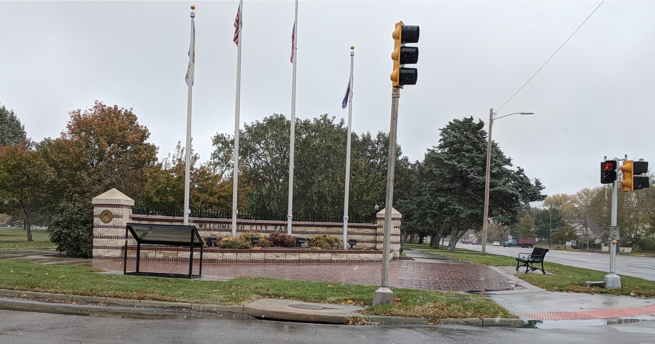 You don’t need to drive 10-15 minutes out of town to get those miles in. The most popular place to walk and run is city park! A one mile concrete loop that features some tree coverage, public bathrooms, and temporarily unavailable water fountains. In addition, the park also has a pool and playground and splash pad. The other side has a few baseball diamond and tennis courts and a basketball court. Theres even an ice skating rink. A few roads run through the park which allow you to break up the maybe monotonous loop after loop. A great, popular, easy option for walking and running.
https://www.mapmyrun.com/routes/view/4574984335

Downtown Poyntz: Easy, Concrete, Short
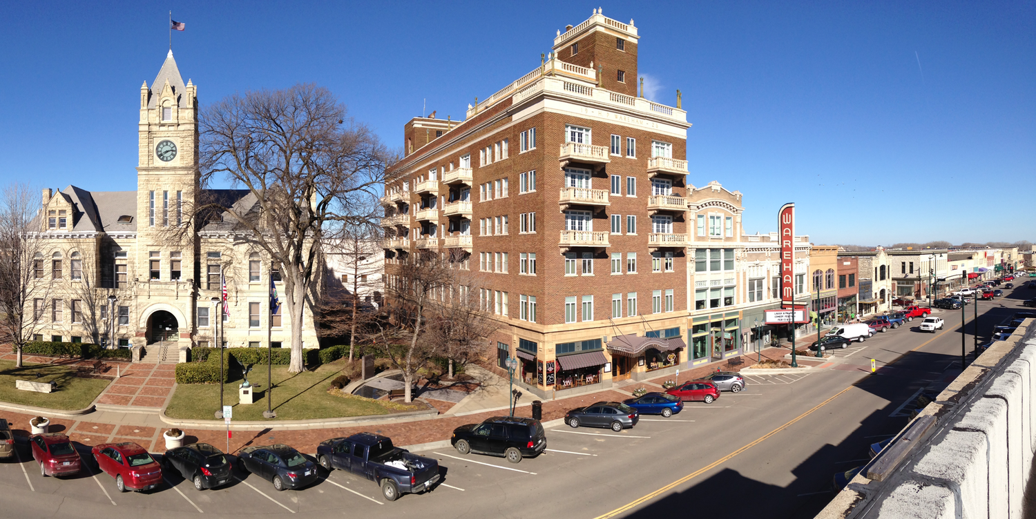
An additional route from city park to break up the laps is to head down Poyntz and run around the mall parking lot and back. This gets you a couple miles that feature stoplights, windows to see your reflection in, and plenty of smiling happy people. Not many people run this route and the streets are wide enough to where you can get some asphalt miles over the concrete sidewalks. Like I said, a nice way to maybe break up the city park laps routine.
https://www.mapmyrun.com/routes/view/4574987185

